Interactive media for Seaplane Harbour exhibition
Is it possible to fly by seaplane from Tahkuna to Orissaarde in today's weather? How was the desertion of Utria defeated? How to read a tree ring? How do mines stay under water? How does a beach battery work? Can the Aegna guns shoot out the Soomen? What are ballast stones talking about? Where is the deepest place in the Baltic Sea? On which day of the week do most accidents happen in the Strait of Muhu?
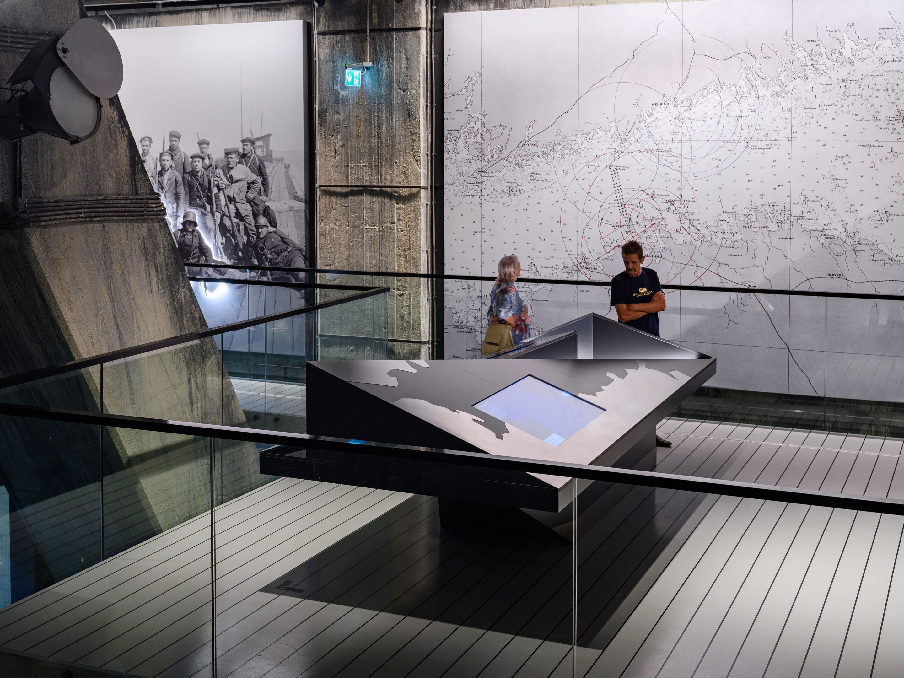
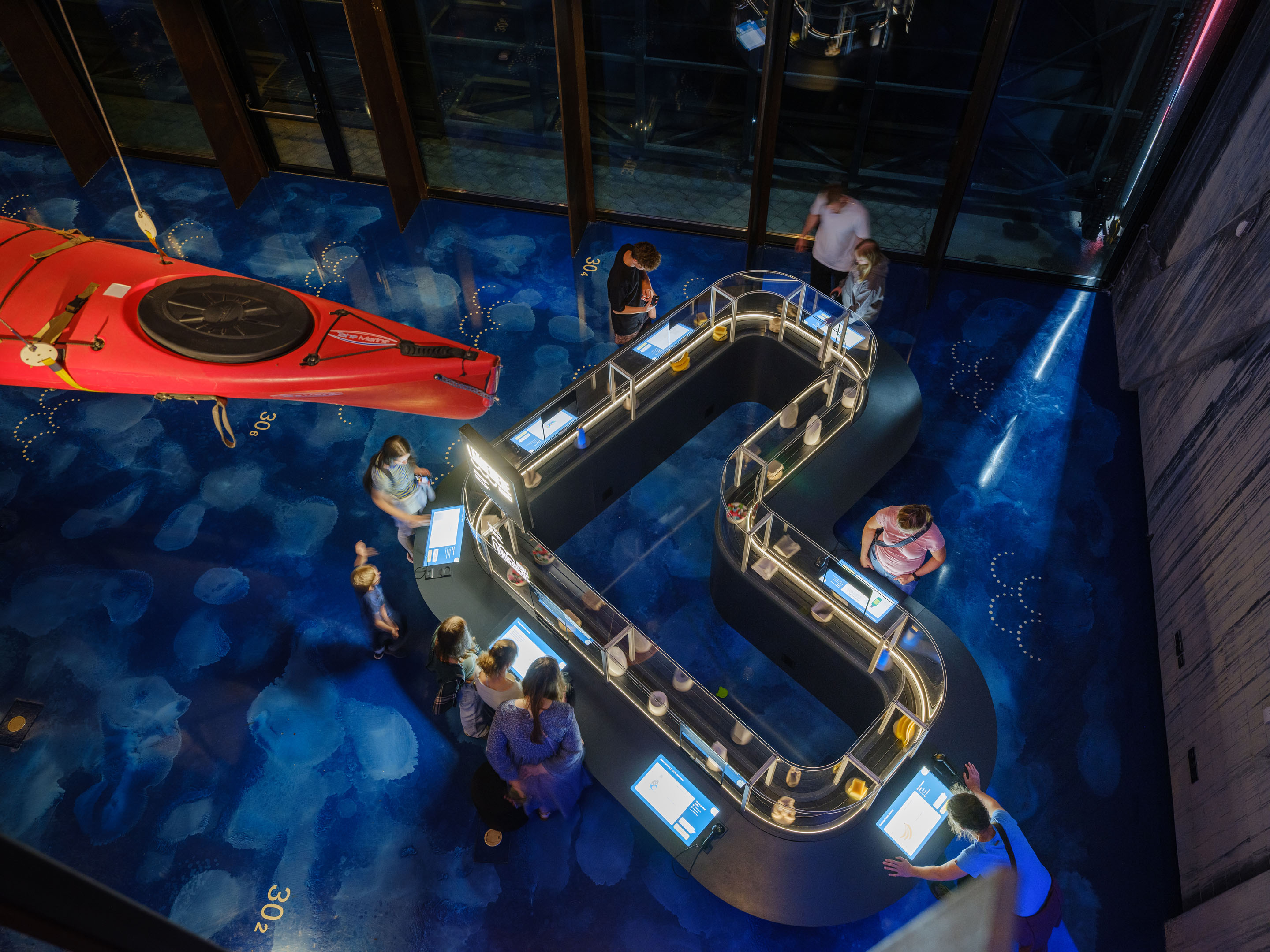
All 15 digital solutions developed, designed, and built for the exhibition are unique in character—some exhibits utilize real-time data and are grounded in extensive research. However, all share a common goal: to introduce visitors to the fascinating worlds of military naval operations, underwater archaeology, and search and rescue (SAR) missions. Through engaging, relatable experiences based on real data, scientific research, and outstanding design, the exhibits aim to captivate the widest range of museum visitors.
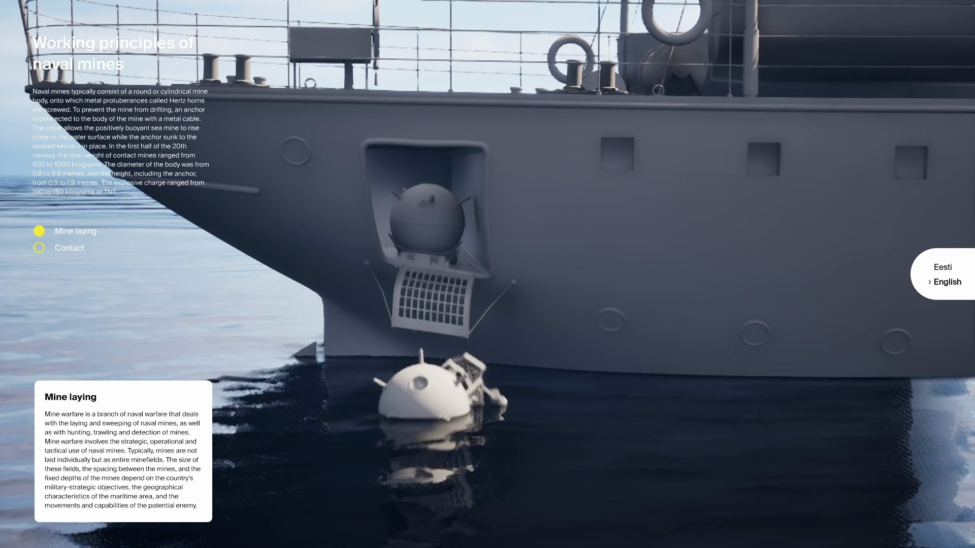
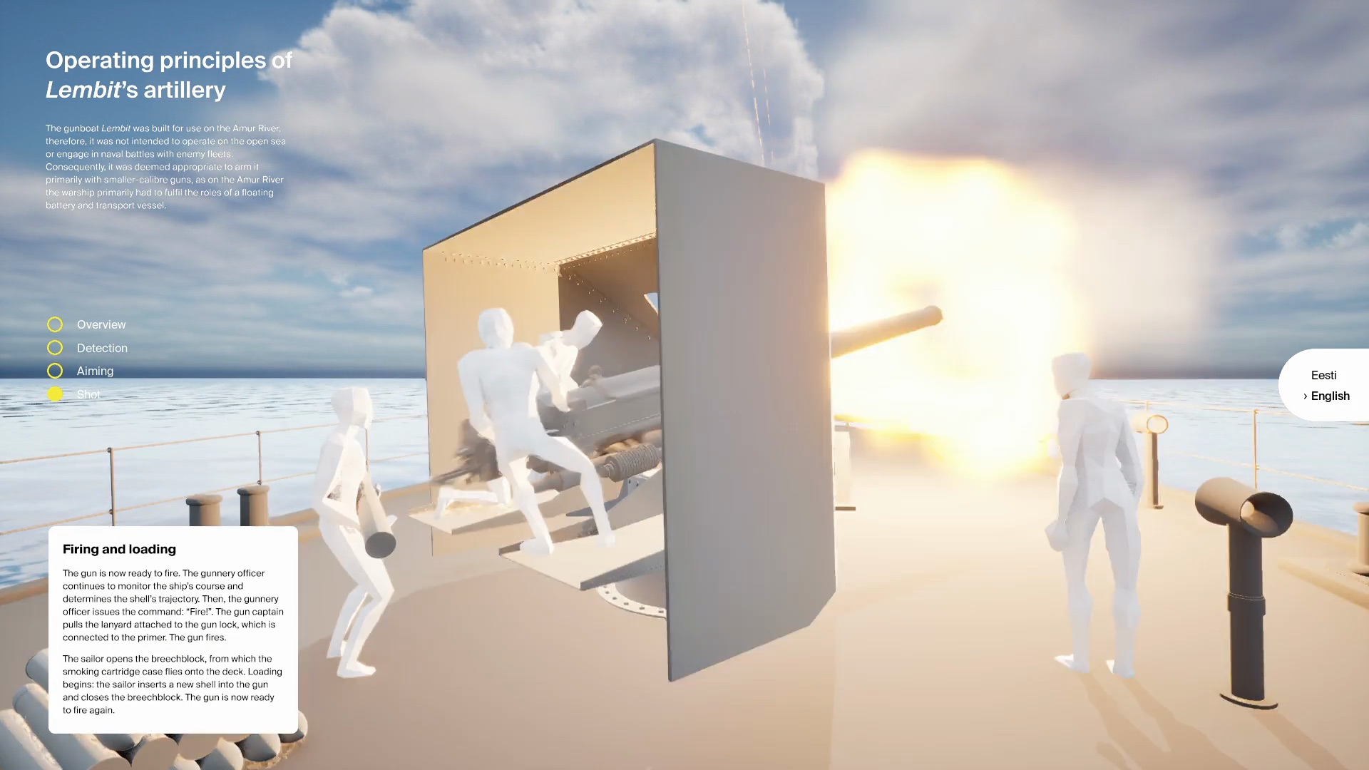
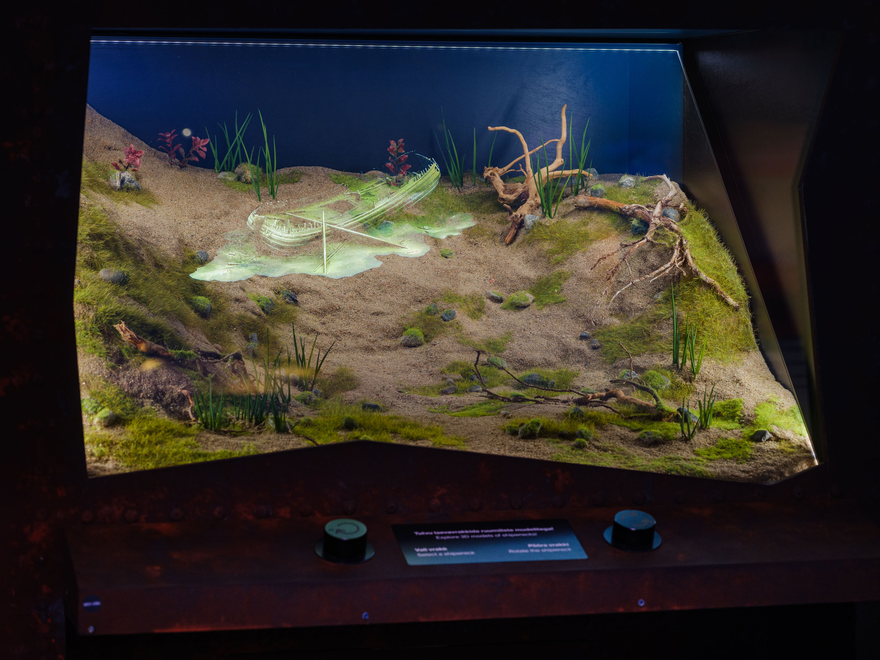
How did the minefields, the submarine Lembit, and the coastal battery actually work? In collaboration with historians, we created detailed 3D models and animations that illustrate their operation. The animations run in a real-time in a 3D engine, allowing users to explore and interact with the scenes dynamically.
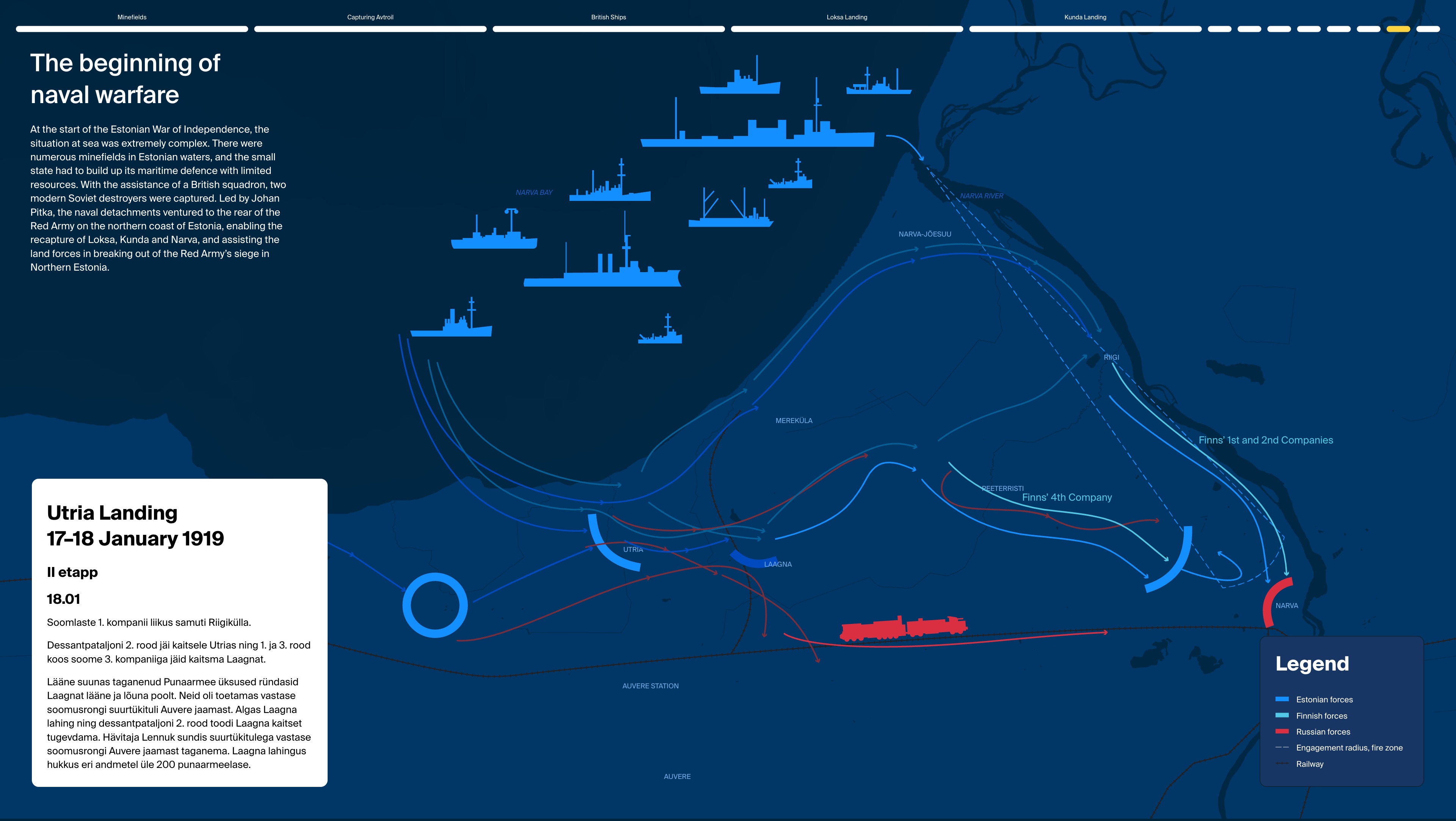
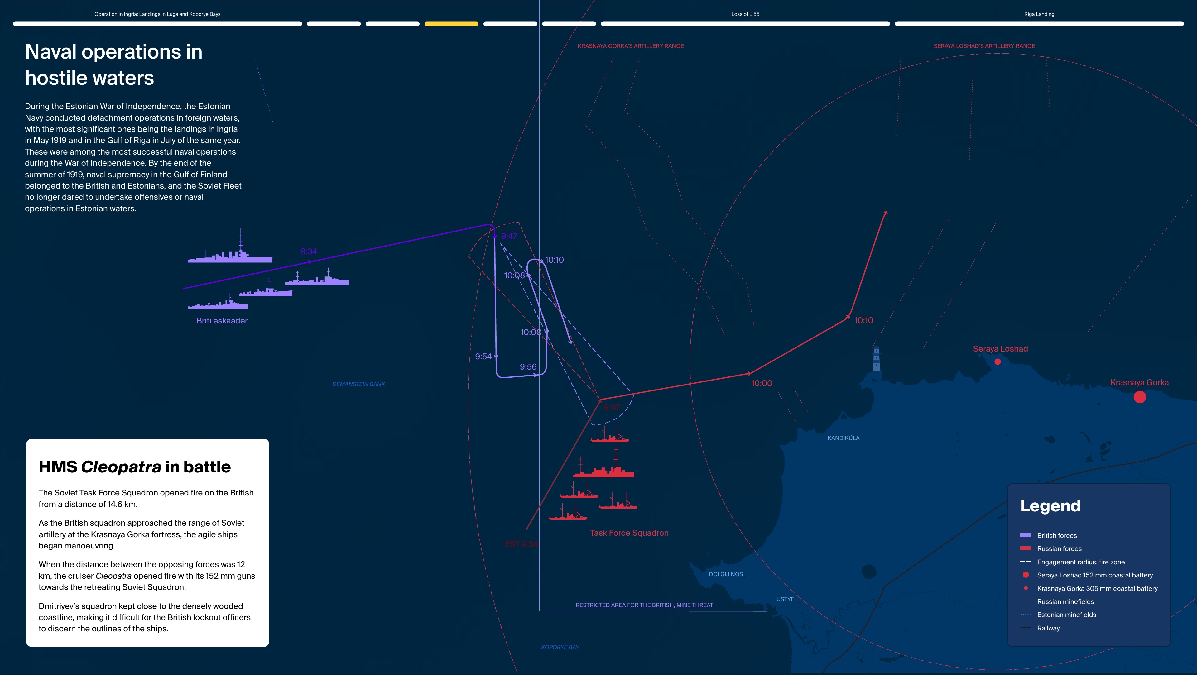
One of the biggest challenges was visualising the operations of the Estonian Navy during the 1930s and the War of Independence. The situation at sea was extremely complex — Estonia faced numerous minefields and had to build up its maritime defence with very limited resources. With the assistance of a British squadron, two modern Soviet destroyers were captured, strengthening the young navy’s capabilities. Under the leadership of Johan Pitka, naval detachments carried out daring missions behind Red Army lines along the northern coast, supporting the recapture of Loksa, Kunda, and Narva, and helping land forces break through the siege in Northern Estonia.
To bring these events to life, we created detailed maps and animations showing the movements and coordination of ships and coastal units. The visualisations are based on historical data and allow users to explore how the operations unfolded across the Baltic Sea.
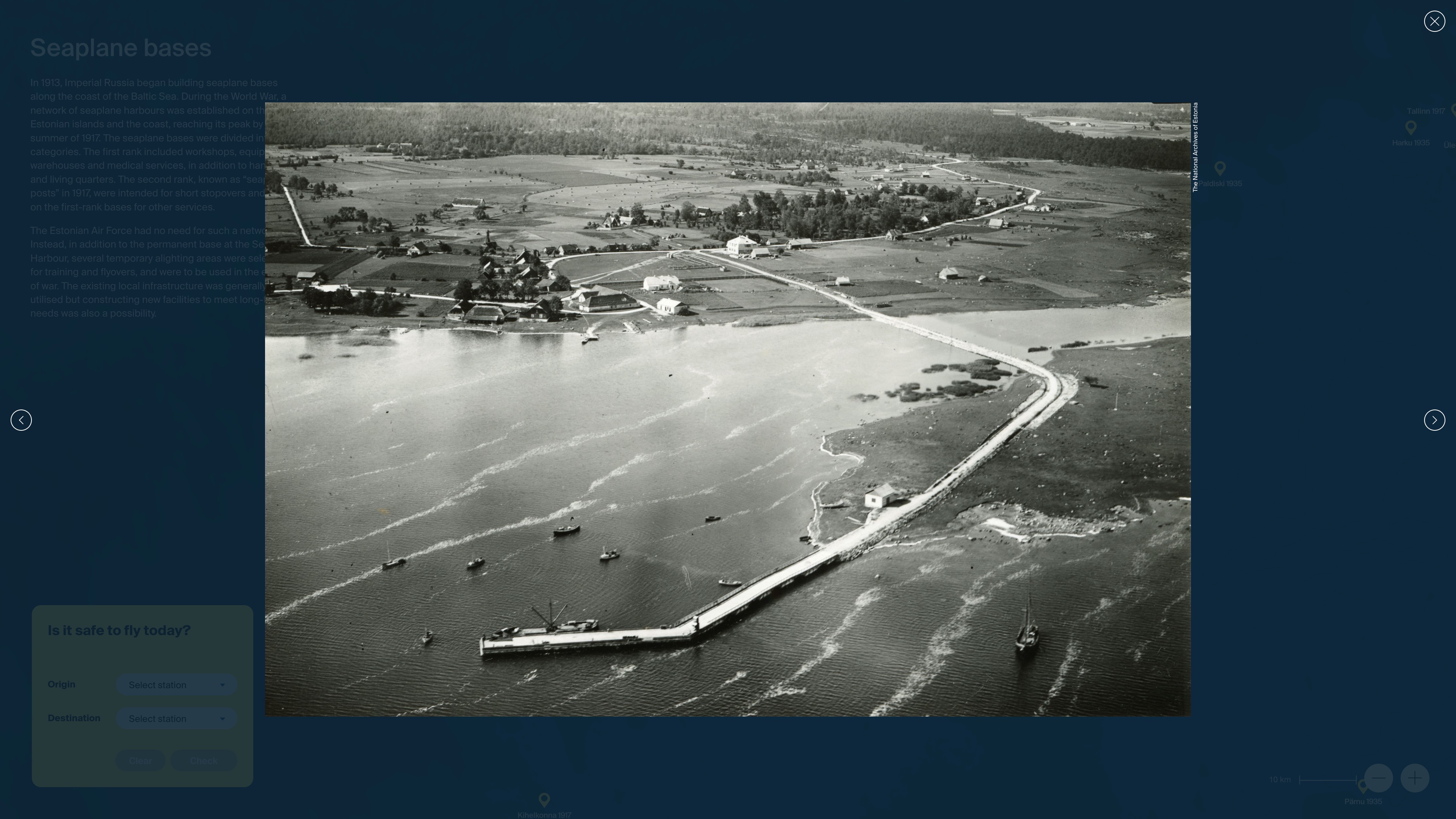
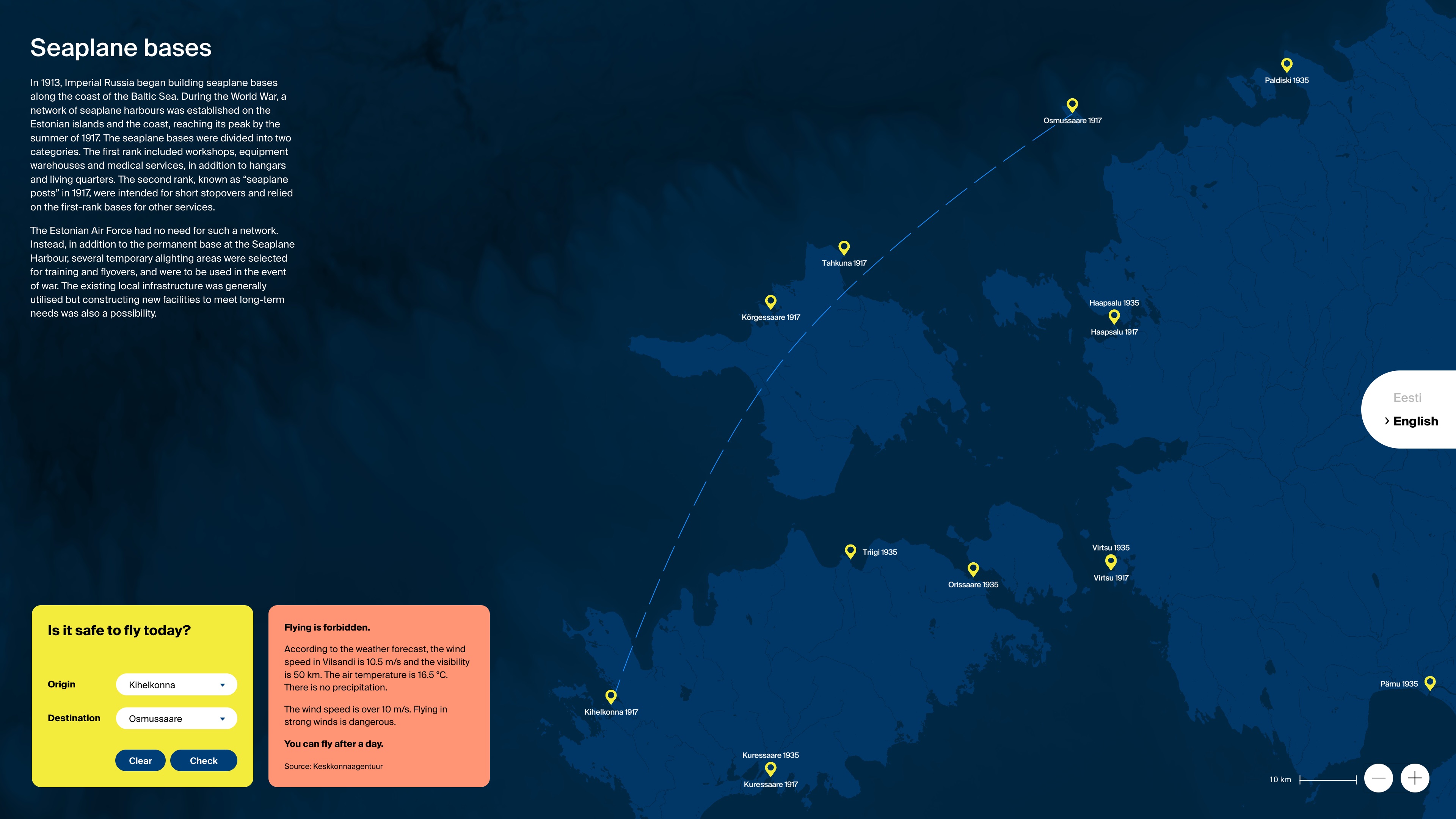
We visualised the historical network of seaplane harbours in Estonia. Using historical maps and archival data, we mapped each harbour showing how seaplanes were deployed across the country. To make the experience interactive, we developed a tool that lets users test whether it would have been suitable to fly a seaplane under today’s real weather conditions — combining historical simulation with live environmental data to bridge the past and present of aviation.
Credits
Digital
Platvorm OÜ
↳ Mikk Meelak, Mikk Pärast, Anneli Kripsaar, Helena Koop, Agnes Ratas, Andreas Wagner
Contribution
↳ Robi Jõeleht, Albert Kerstna, Jaagup Metsalu, Agnes Ratas, Marje Kask, Kristi Rummel-Kottisse, Mai Bauvald, Karri Kaljend, Ingel Martin, Triin Kampus, Kseniia Darmostuk, Syret Kärt, Kadri-Maria Külaots,
Project management
Motor OÜ
Museum
Estonian Maritime Museum
↳ Teele Siig, Mihkel Karu, Urmas Dresen, Priit Lätti, Feliks Gornischeff, Arto Oll, Roman Matkiewicz Tõnis Veltman, Marge Rahu
Photographer
Tõnu Tunnel